For each of the following three steps you only need to download the administrative subdivisions, and their associated files not complete the entire exercise.
-
Download the administrative subdivision for your selected country (Zambia).
-
Download the population raster from Worldpop for your selected county (Zambia).
-
Download the 12 rasters from your selected country (Zambia) and stack them.
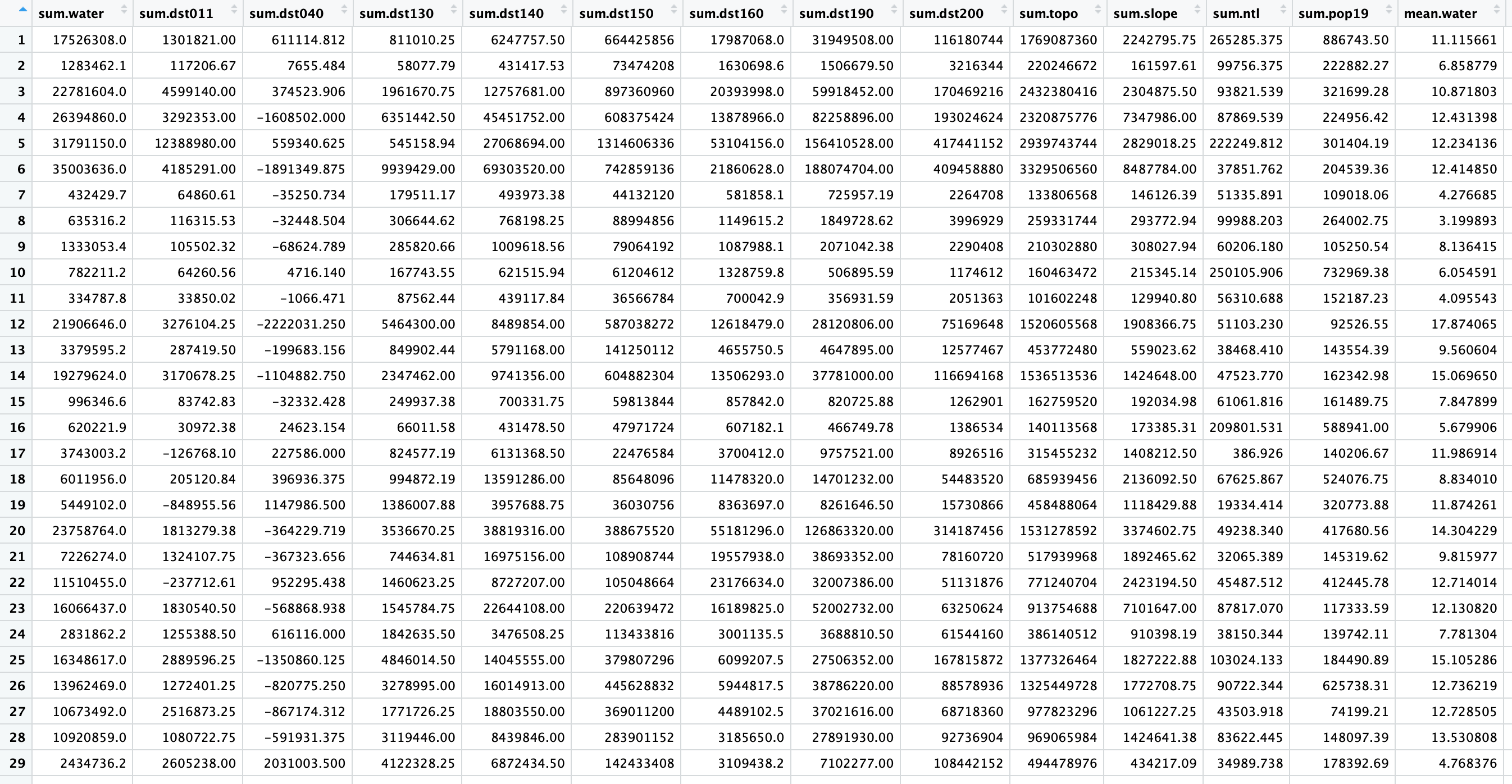
Produce a raster stack and calculate summary statistics.

(this shows only a sample of the stats; 72 rows & 26 columns total)
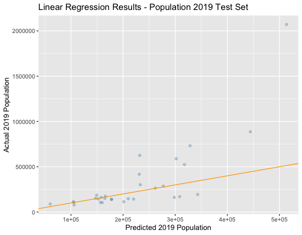
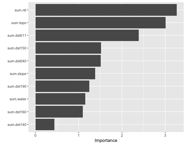
R2 Plot and Variable Importance

